OpenStreetMapから、鉄道情報(芳賀・宇都宮LRT)を引き出して、ダイクストラ計算やってみました。
「OpenStreetMapから鉄道路線データを落とせない」と愚痴っていたら、社内の人から「OSMに鉄道データ入っていますよ」と言われて、愕然とした件
ところが、問題は、
/usr/share/osm2pgrouting/mapconfig_for_bicycles.xml(自転車)
/usr/share/osm2pgrouting/mapconfig_for_cars.xml(自動車)
/usr/share/osm2pgrouting/mapconfig_for_pedestrian.xml(歩行者)
の3つしか、準備されておらず、鉄道のテンプレートがありませんでした。
本当に鉄道を使ったDBはつくれないのかな? と思い、ちょっと試してみました。
こちらに、mapconfig_for_cars.xml があるので、それを見てみました。
私の場合、芳賀・宇都宮LRT と、一般の道路を交えたダイクストラを実現することが目的でしたが、まずは、(道路のことは忘れて)芳賀・宇都宮LRTの情報だけを取り出すことに注力しました。
で、こんなの(mapconfig_for_train.xml)を作ってみました。
ちなみに、"tram"とは路上電車のことで、要するにLRTのことです。
<?xml version="1.0" encoding="UTF-8"?>
<configuration>
  <tag_name name="railway" id="1">
    <tag_value name="tram"              id="101" priority="1.0" maxspeed="40" />
  </tag_name>
</configuration>
id="1"> とか、 id="101" priority="1.0" maxspeed="40" /> は、適当に付けました(多分、この辺は適当で良いと思います)。
で、これで何が出てくるかを見ていたのですが、
<tag_name name="railway" id="1">
<tag_value name="tram" id="101" priority="1.0" maxspeed="40" />
</tag_name>
</configuration>
この結果、分かったことは、osmデータの中にある、<tag k="railway" v="tram"/> が含まれている、<way>のタグが取り出されることでした。
<way id="678320671" version="2" timestamp="2021-08-04T10:06:56Z" changeset="0">
		<nd ref="6351482006"/>
		<nd ref="5948014189"/>
		<nd ref="5558816378"/>
		<nd ref="5948014109"/>
		<tag k="bridge" v="yes"/>
		<tag k="railway" v="tram"/>
		<tag k="electrified" v="contact_line"/>
		<tag k="frequency" v="0"/>
		<tag k="gauge" v="1067"/>
		<tag k="maxspeed" v="40"/>
		<tag k="name" v="(仮称)宇都宮ライトレール"/>
		<tag k="railway" v="construction"/>
		<tag k="voltage" v="750"/>
	</way>
で作った、utunomiya-railway-latest.osm を使って、テスト用のDB (test_db)を作っておいて、
osm2pgrouting -f utunomiya-railway-latest.osm -c mapconfig_for_train.xml -d test_db -U postgres
をやってみました(実は、芳賀・宇都宮LRTの情報は、工事中の情報が入っていて、utunomiya-railway-latest.osmには、<tag k="construction" v="tram"/>と記載されていましたので、これを、強制的に<tag k="railway" v="tram"/>に置換しました)。
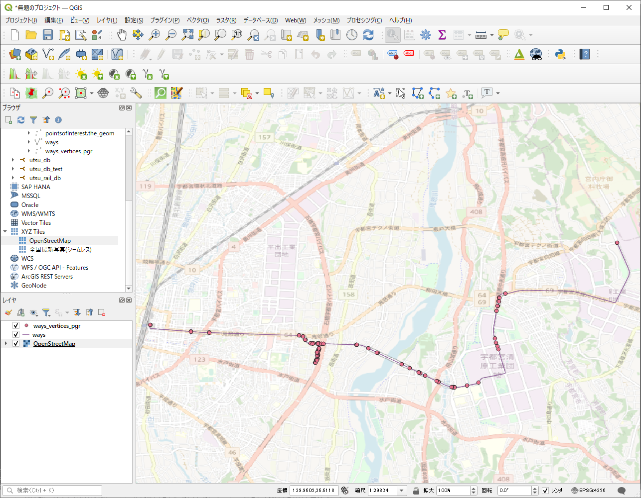
test_dbをQGISで表示したら、こんな感じで出てきました。

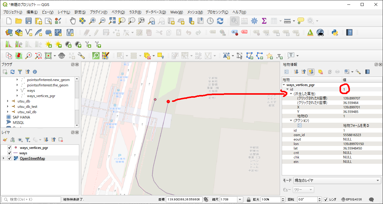
出発点のid = 1 と、

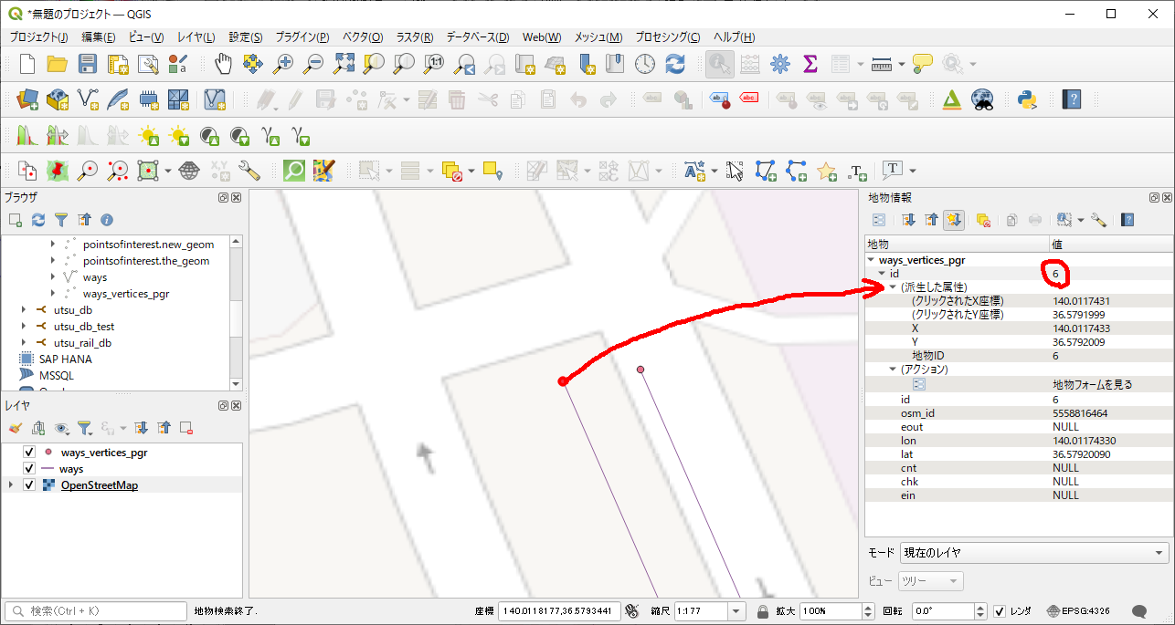
終着点のid = 6 を使って、

ダイクストラ計算を実施してみました。
root@a2b2f7061d88:/tmp# psql -U postgres
psql (12.5 (Debian 12.5-1.pgdg100+1))
Type "help" for help.

postgres=# \c test_db
You are now connected to database "test_db" as user "postgres".
test_db=# SELECT seq, node, edge, cost, agg_cost FROM pgr_dijkstra('SELECT gid as id, source, target,length_m as cost FROM ways',1, 6, false);
 seq | node | edge |        cost        |      agg_cost
-----+------+------+--------------------+--------------------
   1 |    1 |  112 |  968.5677557470831 |                  0
   2 |  105 |    1 |  401.6831070639031 |  968.5677557470831
   3 |    2 |   40 | 1932.1157045557927 | 1370.2508628109863
   4 |   36 |   43 |  91.90138904387848 | 3302.3665673667792
   5 |   39 |   65 | 111.55679510881248 |  3394.267956410658
   6 |   63 |   67 | 159.06195161851494 | 3505.8247515194703
   7 |   65 |   10 | 45.988089536965845 |  3664.886703137985
   8 |    9 |   74 |  25.50249632394143 |  3710.874792674951
   9 |   71 |    8 |  83.08385331794597 | 3736.3772889988927
  10 |    7 |   12 | 27.274859434129702 | 3819.4611423168385
  11 |   10 |   36 |  55.83052462128617 |  3846.736001750968
  12 |   32 |   37 |  48.05528375189372 | 3902.5665263722544
  13 |   33 |    2 |    700.36313814633 |  3950.621810124148
  14 |    3 |   69 | 13.830090594515813 |  4650.984948270478
  15 |   67 |   57 |  269.7483878007764 |  4664.815038864994
  16 |   55 |   13 | 243.90865759717457 |   4934.56342666577
  17 |   11 |   14 |  592.4332460936212 |  5178.472084262944
  18 |   12 |   30 | 197.95743212114834 |  5770.905330356565
  19 |   26 |   44 | 230.11474397115853 |  5968.862762477714
  20 |   40 |   32 |  32.15748444428291 |  6198.977506448872
  21 |   28 |   34 | 128.30514459608628 |  6231.134990893155
  22 |   30 |   46 | 292.51977773825814 |  6359.440135489242
  23 |   42 |   47 |  42.00097102860326 |    6651.9599132275
  24 |   43 |   51 |  317.7487966492082 |  6693.960884256103
  25 |   48 |    3 | 24.366299209335182 |  7011.709680905311
  26 |    4 |    6 |  35.05578311994414 |  7036.075980114646
  27 |   46 |   62 |  269.6784973606185 |   7071.13176323459
  28 |   60 |   71 |  261.6741520558861 |  7340.810260595208
  29 |   69 |   20 | 1312.5430898908662 |  7602.484412651094
  30 |   18 |   72 |  86.31512692490578 |  8915.027502541961
  31 |   70 |    4 |  962.8503750491366 |  9001.342629466868
  32 |    5 |   60 | 131.65329169122384 |  9964.193004516004
  33 |   58 |   59 |  129.1237292961209 | 10095.846296207228
  34 |   57 |   53 |  93.77398873447196 |  10224.97002550335
  35 |   50 |   55 |  200.4322777934951 | 10318.744014237822
  36 |   52 |    7 |  4122.794957245806 | 10519.176292031318
  37 |    6 |   -1 |                  0 | 14641.971249277123
(37 rows)
芳賀・宇都宮LRTの全長は、15kmと聞いていましので、ほぼドンピシャ(14641.971249277123メートル)が算出されていることが分かります。
ただ、現在のnodeの位置は、駅の場所に対応していないので、鉄道情報のosmファイルを手動で作り直す必要はあります(nodeとgeomの変更等)が、その前に、とりあえず今のままの方式で、道路ー鉄道混在のダイクストラができるか、試してみます。
(2時間経過)
こんなのを作って試してみました。
mapconfig_for_cars_tram.xml
<?xml version="1.0" encoding="UTF-8"?>
<configuration>
  <tag_name name="highway" id="1">
    <tag_value name="motorway"          id="101" priority="1.0" maxspeed="130" />
    <tag_value name="motorway_link"     id="102" priority="1.0" maxspeed="130" />
    <tag_value name="motorway_junction" id="103" priority="1.0" maxspeed="130" />
    <tag_value name="trunk"             id="104" priority="1.05" maxspeed="110" />
    <tag_value name="trunk_link"        id="105" priority="1.05" maxspeed="110" />
    <tag_value name="primary"           id="106" priority="1.15" maxspeed="90" />
    <tag_value name="primary_link"      id="107" priority="1.15" maxspeed="90" />
    <tag_value name="secondary"         id="108" priority="1.5" maxspeed="90" />
    <tag_value name="secondary_link"    id="109" priority="1.5" maxspeed="90"/>
    <tag_value name="tertiary"          id="110" priority="1.75" maxspeed="90" />
    <tag_value name="tertiary_link"     id="111" priority="1.75" maxspeed="90" />
    <tag_value name="residential"       id="112" priority="2.5" maxspeed="50" />
    <tag_value name="living_street"     id="113" priority="3" maxspeed="20" />
    <tag_value name="service"           id="114" priority="2.5" maxspeed="50" />
    <tag_value name="unclassified"      id="117" priority="3" maxspeed="90"/>
    <tag_value name="road"              id="100" priority="5" maxspeed="50" />
  </tag_name>
  <tag_name name="railway" id="1">
    <tag_value name="tram"              id="101" priority="1.0" maxspeed="40" />
  </tag_name>
</configuration>
osm2pgrouting -f utsunomiya.osm -c mapconfig_for_cars_tram.xml -d test_db2 -U postgres
(<tag k="construction" v="tram"/>の<tag k="railway" v="tram"/>の強制置換を忘れずに)
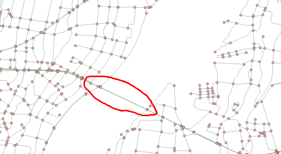
QGISで表示してみたところ、ちゃんとLRTの架橋ができていました。

ただノード接続ができているか不明なので、これから調べてみます(経路が繋がっていないと、ダイクストラ計算はできないはずなので)。駅を手動で作るしかないかな・・・