別に、日本全国の銀行振り込みシステムでなくとも、「システム障害」というのは血の気が引くものです。
Even if it is not a Japan-wide bank transfer system, a "system failure" is still a bloody good thing.
先程、私のメインのPCのドメインネームシステムが動かなくなり、青冷めていました。
I was blue-cold just now when the domain name system on my main PC stopped working.
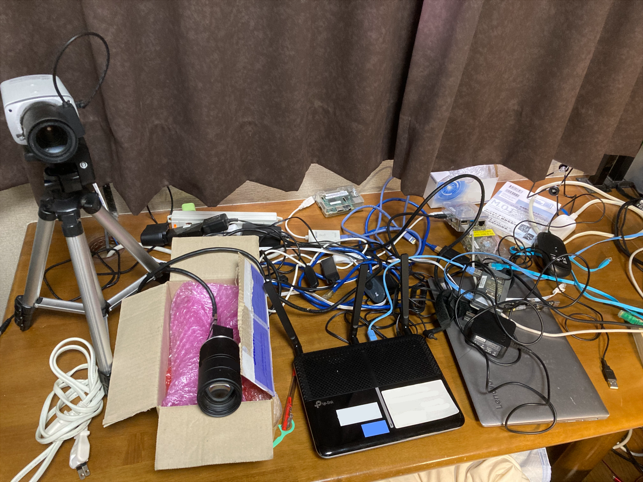
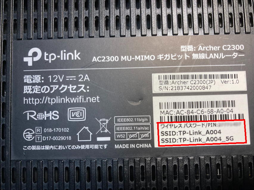
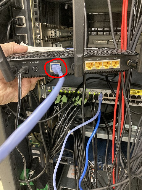
最後の手段として、「ルータの再起動」を実施したのですが、人生でもっとも長い40秒の一つでした。
As a last resort, I implemented a "router reboot," which was one of the longest 40 seconds of my life.
『不調になった機械が、再起動で完全に動かなくなる』 ―― これまで、こんな修羅場に何度立ち会ってきたことか。
I can't tell you how many times I've been in the situation of "a machine that malfunctions and then completely stops working after a reboot.
-----
という訳で、私は病的なまでにバックアップを取るようにしているのですが、この「バックアップ」というのも、あまり当てになりません。
This is why I try to make morbid backups, but this "backup" is also unreliable.
OSを丸ごとイメージコピーしても、日進月歩でハードウェアのスペックも変化していくからです。
This is because even if the entire OS is image-copied, hardware specifications change ever-evolvingly.
「バックアップ」の有効期間というのは、私の感じでは、半年が限界。その後は、単なるハードディスクを消費するだけのファイルに成り果てます。
My feeling is that the maximum "backup" lifetime is six months. After that, they become mere complex disk-consuming files.
-----
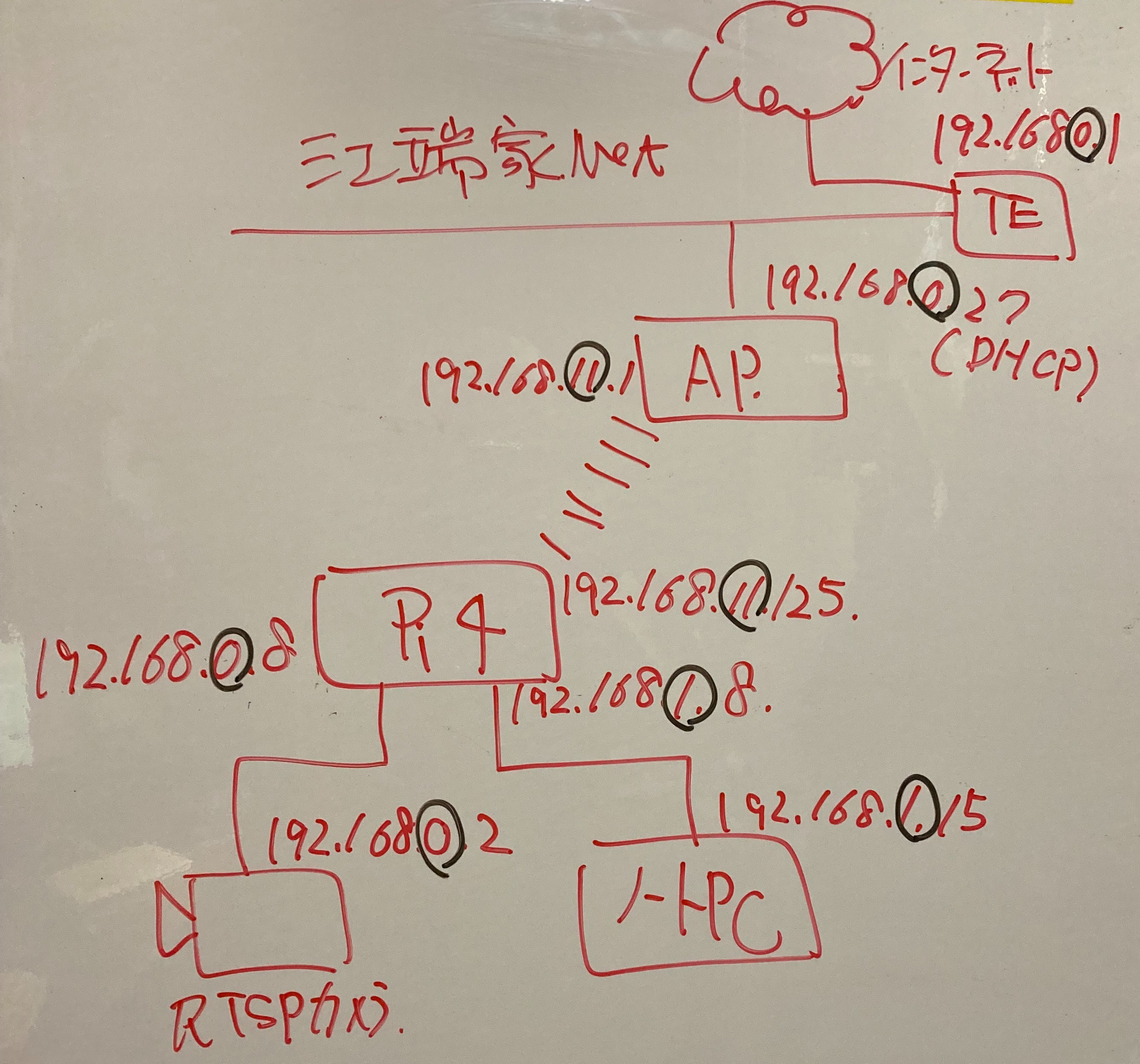
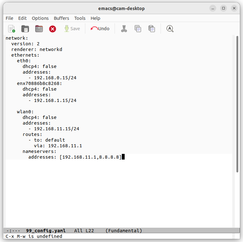
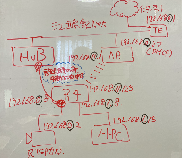
それにしても訳が分からんのは、OSのバージョンを上げる度に、これまで問題なく動いてきたシステムファイルの構成を変えるOSSの開発者の頭の中です。
What is still incomprehensible to me is the mind of the OSS developers who change the configuration of system files that have been working without problems every time they upgrade the OS version.
- /etc/resolve.confを、dhcpの設定ファイルの方に寄せる必要って何?
- What is the need to move /etc/resolve.conf to the DHCP configuration file?
- GUIで提供するなら、全部一括できるようにデザインしておいて欲しい
- If you're going to provide it as a GUI, I'd like to see it designed so that it can all be done at once.
- というか、レガシーな設定を、OSのバージョンアップする度に変更していくバカは、一体どこの誰?
Who in the world is stupid enough to change legacy settings every time the OS is upgraded?
- DockerがマルチOS対応というのは結構ウソです(使ってみれば分かります)し、OSのバージョンによっては全く動かないし。
- It's pretty much a lie that Docker is multi-OS compatible (you'll see if you try it), and some OS versions don't work at all.
- ラズパイはチップを変更されただけで、問題がボロボロ出てくるし。
- And the Raspberry PI is just a chip that's been changed, and the problems are ragged out.
-----
私、自信をもって言えますが、システムへの脅威は「サイバーアタック」よりも、「システムリプレース」だと思っています。
I can confidently say that the threat to the system is more of a "system replacement" than a "cyber attack."
「システムリプレース」すれば、システムは高い確率で障害をおこします。
When a system is "replaced," there is a high probability that the system will fail.
あなたが、どれだけ怒号を撒き散らそうとも、動かんものは、動かん ―― コンピュータシステムとはそういうものです。
No matter how much you throw a tantrum, what doesn't work doesn't work -- that's how computer systems work.
これからも、銀行システムは停止し、飛行機は飛ばなくなり、コンサートチケットは取れなくなり、あなたの診療カルテが消えてなりなります。
The banking system will continue to shut down, airplanes will stop flying, concert tickets will not be available, and your medical records will disappear.
『デジタル化社会』というのは、つまるところそういうことであり、私たちは、そういう、システム停止を前提とした社会で生きることを覚悟しなければならない、ということです。
This is what a "digitalized society" is all about, and we must be prepared to live in such a society based on the premise that the system will stop working.
----
私は、『締切直前のシステムは止まる』『長期休暇明けのシステムは、必ず障害を起こす』と思って日々を生きています。
I live daily thinking, 'The system stops just before the deadline' and 'The system always fails after a long vacation.
この程度のことは、デジタルシステムの初歩の初歩です。
This level of detail is elementary to digital systems.
社会インフラに打撃を与えるのは、これまでは「地震」「火災」「台風」「洪水」などの天災でしたが、今や、ここに「サイバアタック」と「システムリプレース」の脅威が追加されているのです。
Until now, it was natural disasters such as "earthquakes," "fires," "typhoons," and "floods" that dealt a blow to social infrastructure, but now the threat of "cyberattacks" and "system replacements" have been added to this list.
まずは、これを義務教育過程で教える必要があると思います。
First, I think this must be taught in compulsory education.
あるいは、やれることはやって、それでも壊れる時には壊れるという『諦観』をするしかない、とも言えます ―― システム障害も自然災害も。